The best sunset hikes near Santa Barbara, from Lizard’s Mouth rock formations to Inspiration Point ridge views. A local’s guide to timing, parking, and what to bring.
The Best Santa Barbara Sunset Hikes That You’ll Love
There is a moment, usually around 6:45 p.m. in summer, when the light over the Santa Barbara mountains turns from gold to deep amber and everything on the chaparral goes quiet. Locals know to be on a ridge by then. Tourists are usually still in line for fish tacos. That’s not a knock — it just means the trails belong to us for the best hour of the day.
Whether you want a west-facing perch with direct ocean views, a canyon that glows in late-afternoon light, or a ridgeline where you can watch the mountains turn pink as the sun drops, Santa Barbara has it. These are the hikes locals actually do at sunset — ranked by view quality, accessibility, and how reliably the light delivers. Bring a headlamp. It gets dark fast once the sun goes.
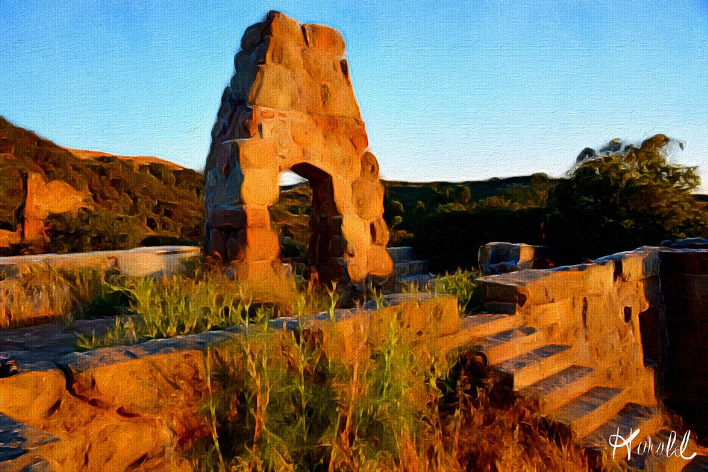
Lizard’s Mouth — Best Actual Sunset Views
If you want to watch the sun drop into the Pacific Ocean with a cold beer in your hand and your feet dangling off a sandstone boulder, Lizard’s Mouth is the move. This is the one west-facing hike on this list with an unobstructed ocean view, and on clear days you can see the Channel Islands laid out in a line like stepping stones.
The trailhead is off West Camino Cielo — take Highway 154 (San Marcos Pass Road) up the mountain, turn right on West Camino Cielo, and drive about 2.5 miles to the signed pullout on the right. The hike itself is only about 1.5 miles round trip over smooth sandstone slabs, which makes it accessible even if you’re not a hardcore hiker. Wear shoes you can scramble in — trail runners or approach shoes work great. Flip flops will get you hurt on the rock surfaces.
Locals arrive 45 minutes before sunset to claim a boulder. On weekends in summer, the spot fills up — arrive an hour early or you’ll be watching over people’s heads. The sandstone formations themselves are worth the trip at any hour, but at golden hour the light turns the rock from gray to warm orange and the whole scene looks unreal. Bring a headlamp — the path back to the car after dark is easy to miss if you don’t know it.
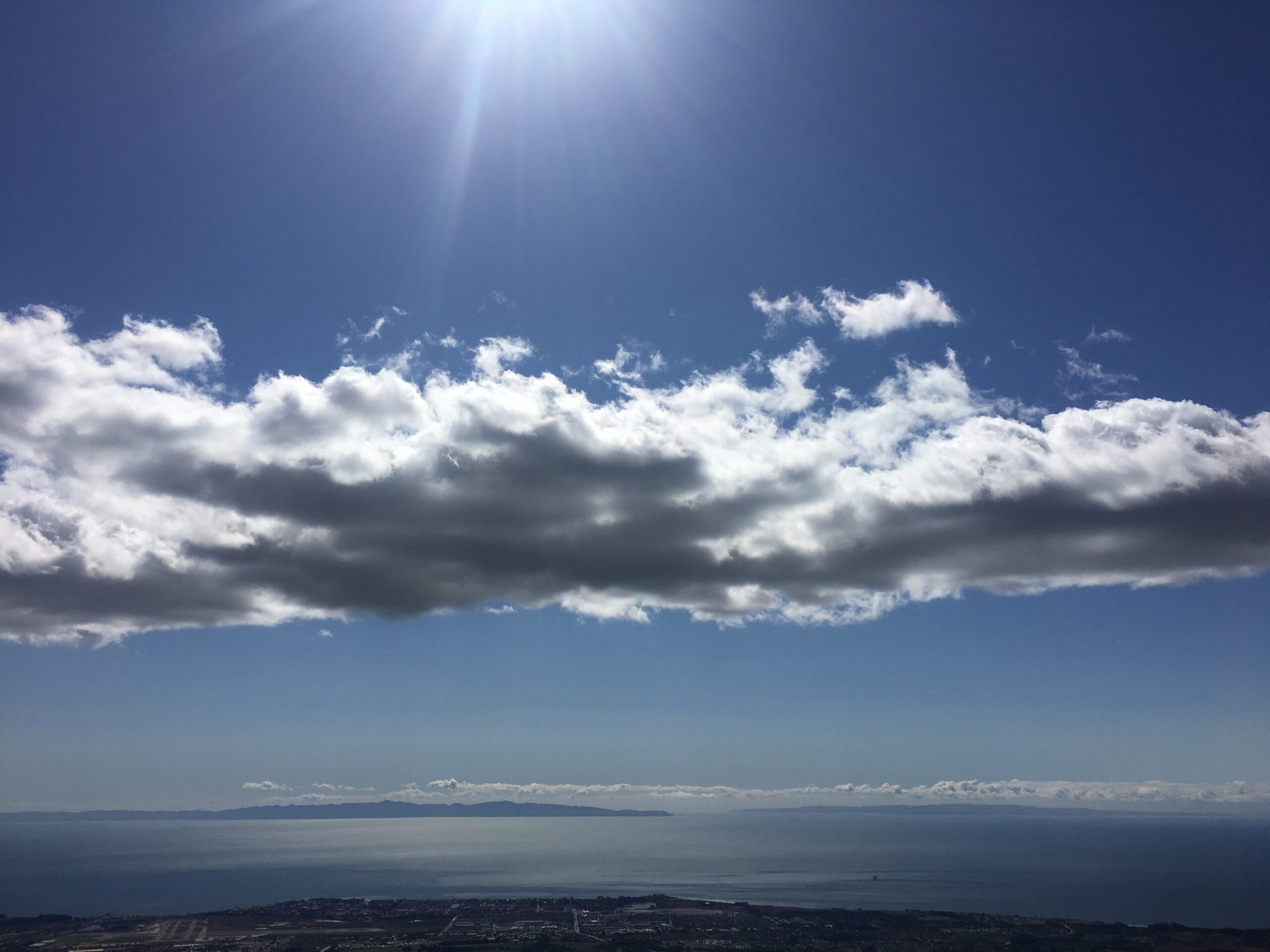
Best months: April through October. Winter fog can kill the sunset, though a socked-in marine layer sometimes produces dramatic pink-and-purple skies after the sun goes below it.
- Distance: 1.5 miles round trip
- Elevation gain: ~150 feet
- Parking: Small pullout on West Camino Cielo — free, no permit needed
- Difficulty: Easy, with some rock scrambling
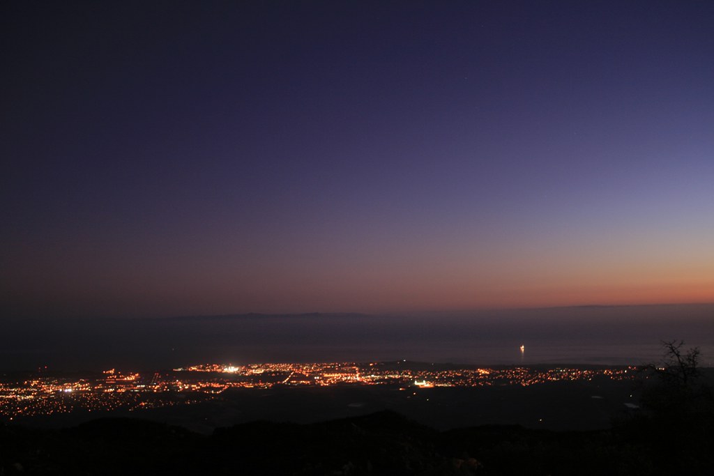
Inspiration Point — Ridge Views and Mountain Light
Inspiration Point is the most popular sunset hike in Santa Barbara, and for good reason. The ridgeline sits at about 1,750 feet and faces east — which means you won’t see the sun actually set, but you will watch the last light of day paint the Santa Ynez Mountains in shades of pink, violet, and deep red while the city below you flickers on. It’s a different kind of sunset experience, and locals who’ve done both usually prefer it on nights when there’s interesting cloud cover over the mountains.
The trailhead is at the end of Tunnel Road in the Rattlesnake Canyon Wilderness. Park on Tunnel Road — street parking only, and it fills up on weekends, so arrive early or plan to walk from further down the road. The trail to Inspiration Point is about 3.5 miles round trip with 800 feet of gain. It’s not hard, but it’s not flat either — you’ll feel it in your legs. Most people in reasonable shape can do it in under two hours.
The trail is part of the Los Padres National Forest system and connects to a web of other trails including Jesusita and the Rattlesnake Canyon trail. Wear real hiking shoes — the trail has loose rock and gets dusty in summer. A good pair of trail running shoes or light hiking boots makes the difference on the descent after dark.
This is also one of the best spots in the city to photograph the sunset’s effect on the mountains — the east-facing orientation means your camera is pointed at the illuminated peaks, not into the sun. Bring a layer. The ridge gets cold fast once the light goes.
- Distance: 3.5 miles round trip
- Elevation gain: ~800 feet
- Parking: Street parking on Tunnel Road — free
- Difficulty: Moderate
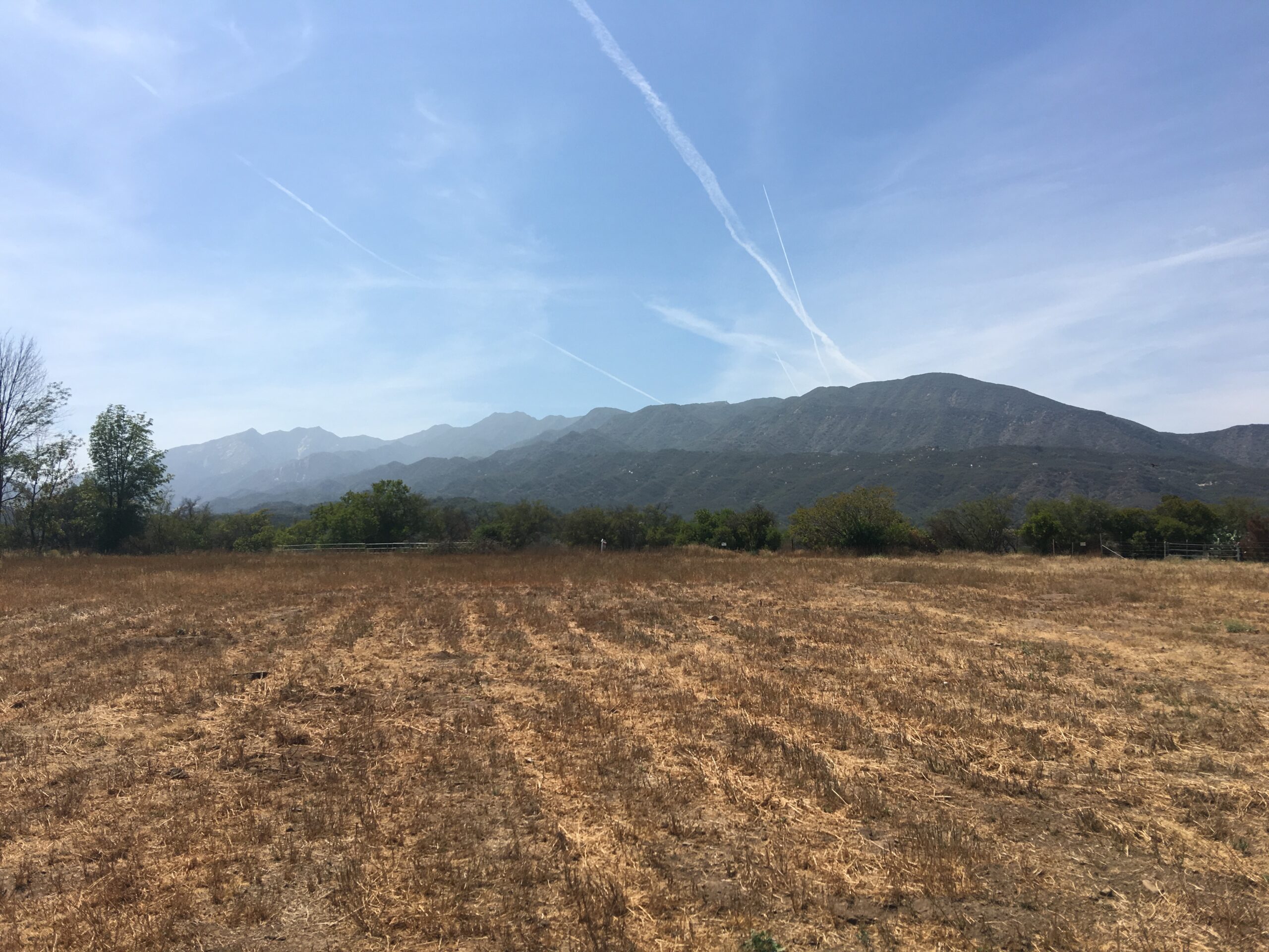
Cold Spring Trail — Canyon Glow and Ridgeline Rewards
Cold Spring Trail is the one locals recommend when someone asks for a hike that feels more like an experience than exercise. The lower trail runs through a shaded canyon with a year-round creek — gorgeous but not a sunset destination. The upper trail, once you climb out of the canyon onto the ridge, opens up to panoramic views of both the ocean and the Santa Ynez Valley. That east-west ridgeline is the payoff.
The trailhead is on Mountain Drive east of the intersection with Stanwood Drive. The canyon section is well-marked and easy to follow. Once you gain the ridge (about 2 miles and 1,600 feet of gain from the trailhead), you have options — continue west toward the TV towers area for better ocean views, or settle in on the ridge itself and watch the light change across the valley below.
This one requires more fitness than Lizard’s Mouth or Inspiration Point. The gain is real and the upper trail is exposed — bring sunscreen and more water than you think you need, especially in summer. But for locals who want a proper workout that ends with a view, this is the standard. AllTrails has a current conditions map — check it before you go, especially after rain, as the creek crossings can be slippery.
Start no later than 2.5 hours before sunset if you want to reach the ridge in daylight. Pack a light daypack with water, snacks, a headlamp, and a windshell — the ridge can be 15 degrees colder than the trailhead.
- Distance: 4–6 miles round trip depending on how far you go on the ridge
- Elevation gain: 1,600–2,200 feet
- Parking: Small lot on Mountain Drive — free, but limited
- Difficulty: Strenuous
Rattlesnake Canyon — Accessible Ridge with Big Payoff
Rattlesnake Canyon is the locals’ everyday hike — close to town, easy to park, and varied enough that you can do a short version or a long one depending on how much daylight you have left. The lower canyon trail follows a creek through oak woodland and is beautiful any time of day. The upper trail climbs to a ridge with 360-degree views that face west toward the ocean.
The trailhead is at the end of Las Canoas Road, a short drive up from Mission Canyon. There’s a small parking area — it fills up on weekends, so aim for a weekday or arrive before 4 p.m. to claim a spot. From the trailhead, the hike to the upper ridge junction is about 3 miles round trip with 1,100 feet of gain. You can extend it to connect with Inspiration Point if you have the legs for it.
What makes this a good sunset hike is the combination of accessibility and reward. The gain is steady but not brutal, the trail is well-maintained, and the upper viewpoint has a west-facing clearing that locals use as a natural amphitheater for watching the light change. You’re not looking straight at the ocean the way you are at Lizard’s Mouth, but on hazy evenings the silhouettes of the mountains against the orange sky are something else entirely.
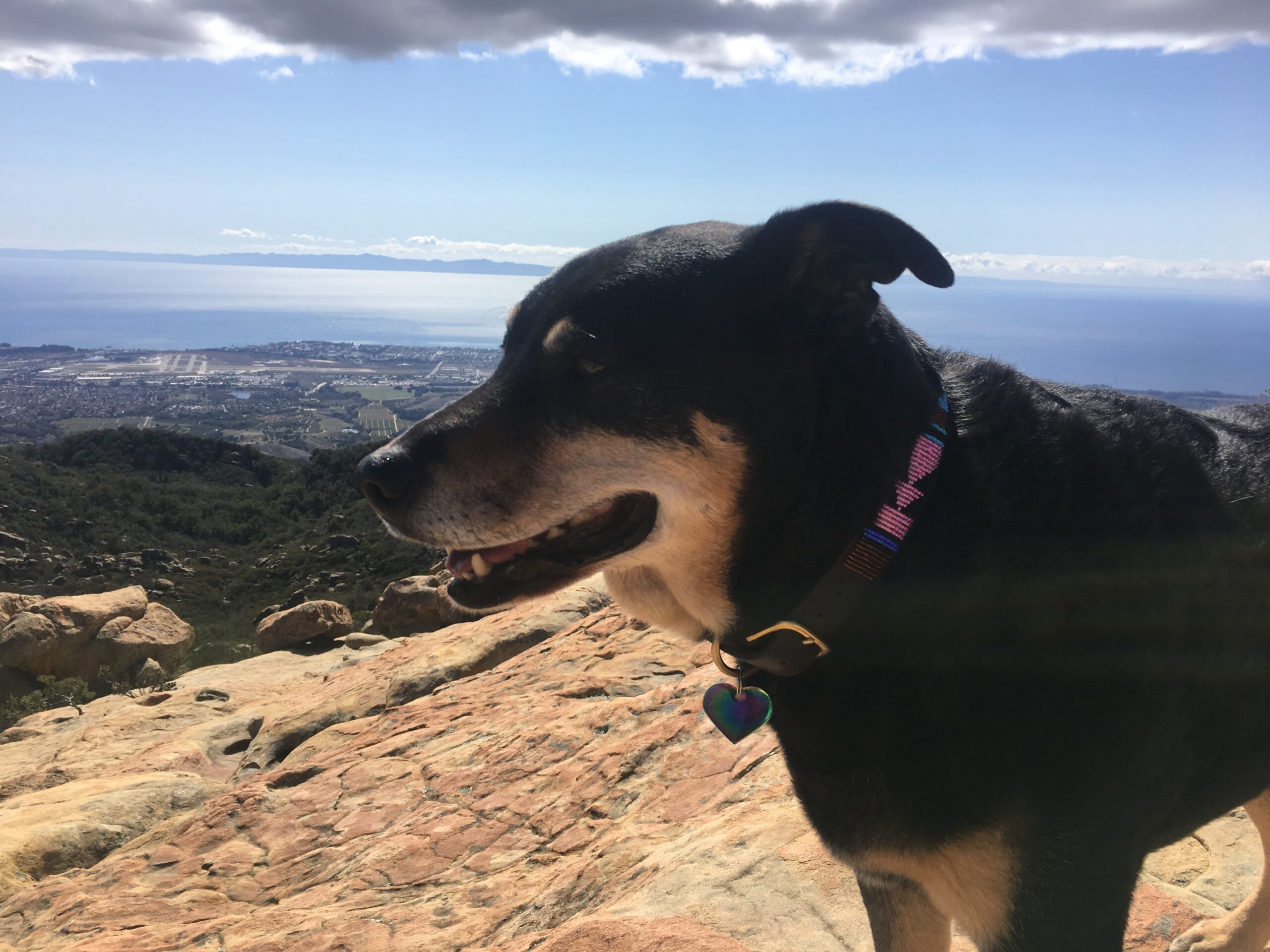
Dogs are allowed on leash. This trail sees a lot of wildlife — we’ve run into deer, coyotes, and rattlesnakes (the trail name is not ironic), so watch your footing and don’t let small dogs off-leash. A pair of trekking poles helps on the descent in the dark.
- Distance: 3–5 miles round trip
- Elevation gain: 1,100–1,500 feet
- Parking: Small lot at Las Canoas Road — free
- Difficulty: Moderate
Gaviota Peak — Remote, Uncrowded, Worth Every Step
Gaviota Peak is the one locals keep to themselves a little. It’s not a quick after-work hike — the trailhead is about 30 miles west of downtown Santa Barbara off Highway 101 at Gaviota State Park, and the hike to the summit is 6 miles round trip with 2,100 feet of gain. But the payoff is a 360-degree summit view that takes in the Pacific Ocean, the Santa Ynez Valley, and on clear days, the Channel Islands. You will not see another hiker up there on a Tuesday evening.
The trail starts at the hot springs trailhead inside Gaviota State Park — there’s a day use fee to enter the park, currently $10 per vehicle. Follow the hot springs trail to the peak junction, then climb steeply to the summit. The upper section is exposed and can be windy — bring a real wind layer, not just a hoodie.
To catch sunset at the summit, you need to start hiking no later than 3 hours before sunset. In summer that means a 4 p.m. departure for a 7 p.m. sunset. Plan to hike out with headlamps — the trail is well-defined but the descent is loose in places. This is the hike where gear matters: supportive hiking boots with ankle stability are worth it for the rocky upper section. If you’re driving out from Santa Barbara, compare car rental rates — Gaviota isn’t reachable any other way, and weekend rates book fast in summer.
If you’re planning a guided hiking experience in the Santa Barbara backcountry, local guided hike tours run into the Santa Barbara backcountry — book ahead if you want a knowledgeable guide who knows the route, the wildlife, and the best viewpoints.
- Distance: 6 miles round trip
- Elevation gain: 2,100 feet
- Parking: Gaviota State Park — $10 day use fee
- Difficulty: Strenuous
Local Tips for Sunset Hiking in Santa Barbara
After years of doing this, here’s what we’ve learned that the trail apps won’t tell you.
Timing: Check the exact sunset time for the date, not a general estimate. Santa Barbara sunsets range from 5:00 p.m. in December to 8:00 p.m. in late June. Golden hour starts about 45–60 minutes before sunset. Add your hike time plus 20 minutes of buffer. If you’re late, you’ll be rushing down a rocky trail in the dark — not ideal.
The marine layer: Santa Barbara’s notorious June gloom (technically a marine layer that peaks in May and June) can block the actual sunset view even on otherwise clear days. But don’t bail on your hike — a thick marine layer often produces dramatic pink-and-purple skies above the fog line. Check the National Weather Service or Windy.com for cloud base height before you go.
What to bring: Every sunset hike needs a headlamp, a layer (temperatures drop 15–20 degrees after sunset in the mountains), water (at least 1 liter per person for anything over 3 miles), and snacks. A reliable headlamp is non-negotiable — your phone flashlight will not cut it on a rocky descent.
Parking reality: Tunnel Road (Inspiration Point) and Las Canoas Road (Rattlesnake Canyon) are narrow residential streets and street parking is limited. Arrive by 4 p.m. on weekends, or carpool. Mountain Drive for Cold Spring has a small lot that fills by 3 p.m. on busy weekends. Lizard’s Mouth has the most flexibility since it’s accessed from the upper mountain road.
Wildlife: Rattlesnakes are active through October, especially on warm evenings when rocky trails retain heat. Watch where you step, especially off-trail. Mountain lions are present in the backcountry — stay aware, especially at dusk on more remote trails like Gaviota Peak. We’ve been hiking these trails for years without incident, but pay attention.
Best months overall: September and October are the sweet spot — summer crowds have thinned, the marine layer is usually gone, and the light quality in fall is exceptional. Late March through April is also excellent, with longer days and green hillsides before the summer dry season turns everything gold.
If you’re visiting Santa Barbara and want to make the most of the hiking, the Visit Santa Barbara hiking page has current trail conditions and ranger contact info. And for the best local trail maps and community conditions reports, AllTrails Santa Barbara is what most locals actually use.
Get up there. The trails sit right above the city and most visitors never go — that’s your advantage. Check current trail conditions on AllTrails, grab a good headlamp before you go, and pick your ridge. The view will be yours.